Unique Places to Save currently working to increase ecological diversity and recreation opportunities along the Brunswick and Lower Cape Fear Rivers.
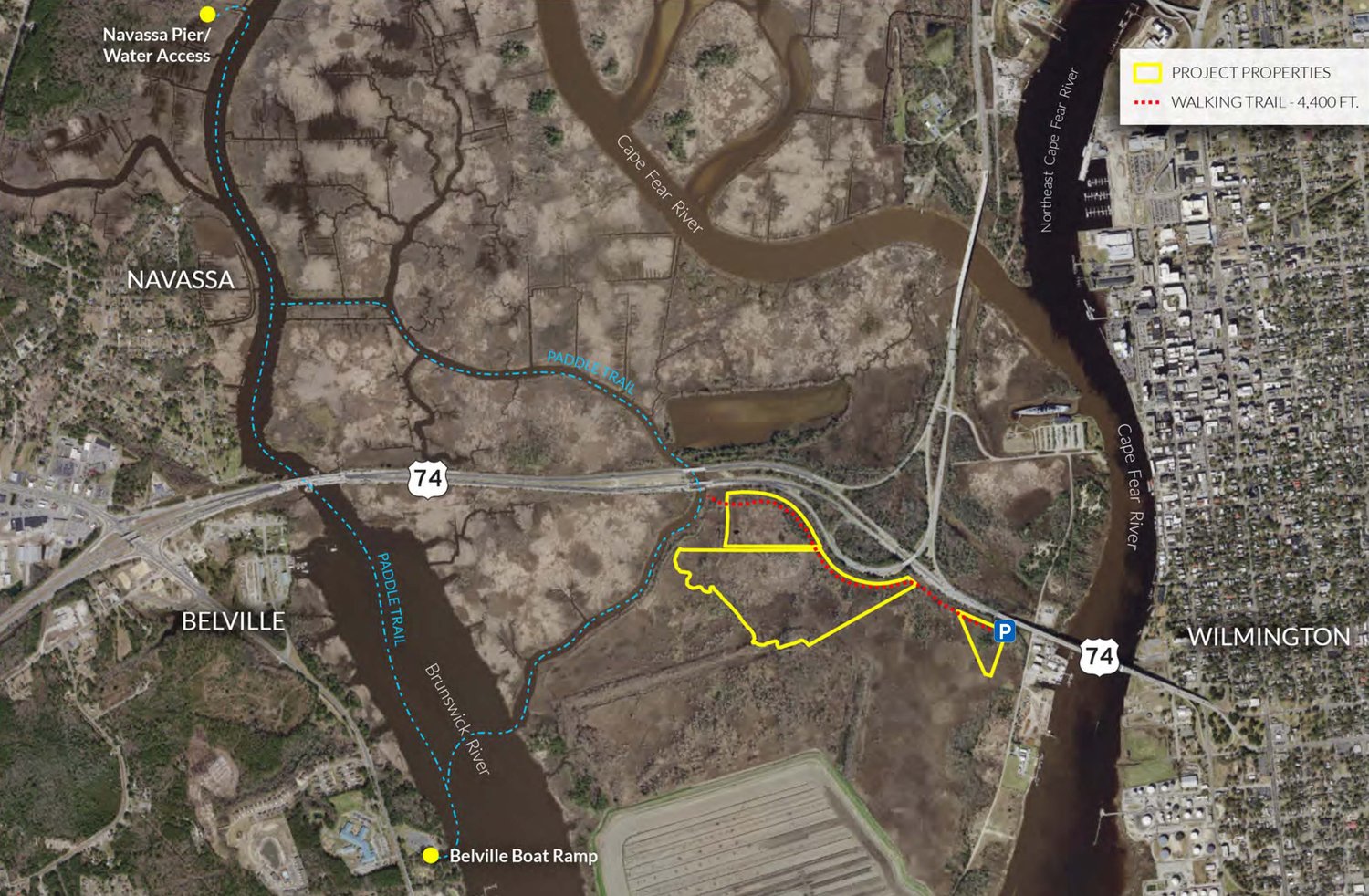
The Alligator Creek Restoration and Conservation Project, funded by the National Fish and Wildlife Foundation, Damage Assessment Response and Restoration Program under the direction of the Natural Resource Trustee Council (National Oceanic and Atmospheric Administration, US Fish and Wildlife Service, and NC Department of Environmental and Natural Resources), will help replace or offset the injured environmental resources resulting from the release of hazardous substances at the Kerr-McGee Chemical Corp. Superfund Site in Navassa, North Carolina (hereafter referred to as the Impact Site). The Alligator Creek Restoration Site is located immediately south of US Highway 17/74/76 on Eagles Island in Brunswick County, North Carolina, less than two miles downstream of the Impact Site on the Brunswick River. The project provides not only natural resource benefits, but also important educational and recreational opportunities for local residents of the surrounding municipalities (e.g. Navassa, Leland, Bellville, and Wilmington) as well as visitors to the area.
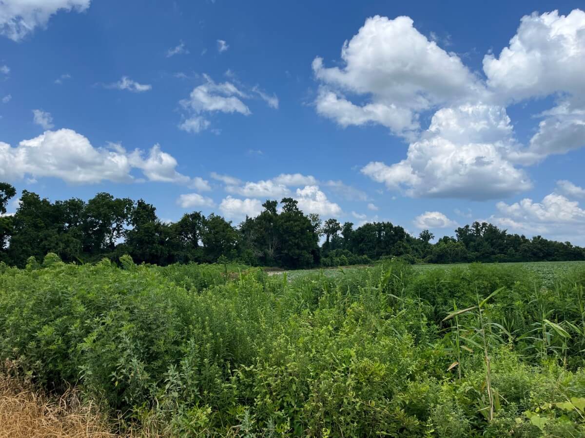
In partnership with New Hanover County Soil and Water Conservation District, the project site consists of approximately 80 acres of historically manipulated tidal wetlands adjoining Redmond Creek, a tributary of the Brunswick River. Prior anthropogenic impacts have resulted principally from the use of the broader area (to the east and south) as a dredge disposal site for the long-term maintenance and deepening of the Wilmington Harbor Channel (a federal navigation project under the authority of the Corps of Engineers). Dredge disposal activities have altered tidal hydraulics of the Alligator Creek system such that nearly the entire reach of the Alligator Creek channel has infilled over the last 60 years to the extent that the channel no longer exists and is virtually indistinguishable from the adjacent marsh surface. Historic disturbance of tidal wetland areas and alteration of the tidal dynamics has also resulted in the proliferation of the invasive common reed (Phragmites australis) and the shift in species composition to a monoculture stand of Phragmites in broad areas within and adjacent to the restoration site.
The Alligator Creek Project will restore an approximate 1,900-ft reach of Alligator Creek and adjacent tidal wetlands. Re-establishment of this main channel, and likely an additional 2,000 ft of smaller order creeks, will increase tidal amplitude and restore ecologically significant Primary Nursery Area (PNA) and tidal creek subtidal and intertidal benthic habitat. In addition, it will provide ecological uplift to disturbed tidal wetlands currently dominated by the invasive Phragmites. Increased tidal exchange resulting from creek restoration will provide for increased refuge and foraging habitat for estuarine-dependent finfish and shellfish while promoting increased primary productivity and detrital export. Diurnal flooding of Phragmites stands will reduce its growth and proliferation. In addition, the project will incorporate the restoration and enhancement of tidal riverine wetlands via removal of historic fill material and planting of characteristic hardwood and softwood species (i.e. bald cypress). A berm or similar engineering approach will also be used to address sea-level rise impacts to the existing sweet gum/cypress wetlands at the site. Native wetland plantings will be used to stabilize restoration design features and provide additional ecological uplift by providing species’ preferred habitat. Cumulatively, these restoration activities will help to replace natural resource assets and services lost or degraded at the Impact Site. In addition, the Project incorporates ancillary recreational and educational components, namely, a nature trail, viewing dock with kiosk/signage, elevated walkway/pier for kayak access. The project will dovetail with other Brunswick River Blueway routes (existing and proposed) and is in proximity to existing boat and paddle launches.
The views and conclusions contained in this document are those of the authors and should not be interpreted as representing the opinions or policies of the U.S. Government or the National Fish and Wildlife Foundation and its funding sources. Mention of trade names or commercial products does not constitute their endorsement by the U.S. Government, or the National Fish and Wildlife Foundation or its funding sources.